
Climate change triggered a landslide in Northeast Greenland, causing the entire Earth to vibrate for nine days
Rocks and ice with a total volume of 25 million cubic metres fell into the remote Dickson Fjord in Northeast Greenland in September last year. This created a 200-metre-high tsunami wave and caused tremors that could be measured around the globe. A large international research team has now meticulously mapped the event using various data, gaining a better understanding of how a warmer climate can cause similar incidents in the future.

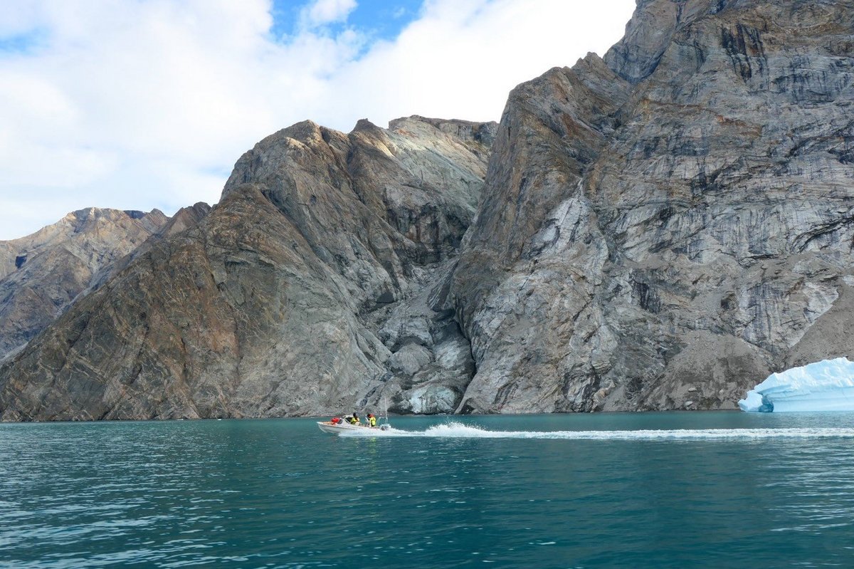
Northeast Greenland is an enormous desolate area, rarely visited by people. Fortunately, no one was harmed when a 200-metre-high tsunami wave rose after a large rock fell into one of the area’s many fjord systems last September.
However, it could have gone terribly wrong as large cruise ships visit these areas when the fjords are ice-free in August and September.
In the summer, a handful of researchers also navigate the fjords in small boats to study how climate change affects the Arctic ecosystem. One of them is Søren Rysgaard, co-author of the study, professor and head of the Arctic Research Centre at Aarhus University.

Søren Rysgaard was in the area with colleagues a few days before the fatal landslide occurred. They set up a measurement station right below the 1.2-kilometre-high cliff that slid into the fjord, blissfully unaware of what would happen a few days later.
Surprising signal
Around the world, there are sensitive seismic measuring instruments that record vibrations in the Earth’s crust. Often, the vibrations are caused by earthquakes, but the instruments can also measure movements in the ground caused by ocean water masses.
In September 2023, the seismic instruments recorded a unique signal, and researchers worldwide were puzzled by this signal they had never seen before.
Where one usually sees many different frequencies on the instruments, this time, for nine days, only a single frequency occurred, like striking a single key on a piano.
“We had no idea what created this signal, which was recorded from the Arctic to Antarctica,” explains Kristian Svennevig, lead author of the article and senior researcher at the Geological Survey of Denmark and Greenland (GEUS).
“Together with 67 other scientists from forty research institutions and fifteen different countries, we have now, using data from various sources, collectively pieced together a complex puzzle that tells us what happened,” says Kristian Svennevig about the work, which is published today in the highly profiled journal Science.
A glacier at the foot of the mountain massif has become thinner and thinner over the past decades. This led to the mountain top losing its support and collapsing into the fjord, creating a wave that oscillated about 10,000 times back and forth in the relatively narrow Dickson Fjord with 90-second intervals over nine days. This shook the ground and created the unique signal on the seismic equipment.
The researchers call the phenomenon a ‘seiche.’ The word comes from a Swiss-French dialect word meaning ‘to swing back and forth’ and describes a standing wave in a closed or partially closed area.
Kristian Svennevig emphasises that the goal was only reached through intense and targeted collaboration between the many researchers and points out that the study has established new scientific collaboration environments across national and research boundaries.
Risk of more Arctic tsunamis
Søren Rysgaard and his research team are based on Ella Island, located 70 kilometres from Dickson Fjord. Here, the Sirius Dog Sled Patrol also has their summer station. When the wave hit Ella Island, it was only 4 metres high but ran 80 metres inland and destroyed much equipment. Fortunately, no one was at the base when it happened.
Researchers have placed a series of measurement stations and cameras around the fjord systems, which send online data back to the researchers year-round.
“Our instruments fortunately survived the violent tsunami, but it’s frightening to think about what could have happened if we, Sirius or a large cruise ship had been in the area during the tsunami,” says Søren Rysgaard.
Several historical and archaeological sites around the fjord system were destroyed by the tsunami.
“With our instruments, we could see the events as they happened. The many measurement stations we have set up provide us with invaluable information about the conditions in Northeast Greenland and how things are changing due to the warmer conditions in the Arctic,” says Søren Rysgaard.
The research team is busy setting up automatic measurement stations along the entire east coast of Greenland. This work primarily takes place during the short summer when the area is ice-free.
The study, published today in Science, concludes that it is particularly important to measure and assess the effects of rapidly accelerating climate change in areas previously considered stable.

“Our work shows that climate change already has a significant impact in Northeast Greenland. The landslide that created the tsunami occurred because a glacier had melted over the past decades. In the future, we must be particularly vigilant and prepared for massive landslides in the Arctic region and the tsunamis that can follow such slides,” says Kristian Svennevig.
Read the scientific paper her: http://www.science.org/doi/10.1126/science.adm9247
Additional Information:
Kristian Svennevig, Senior Researcher, the Department of Mapping and Mineral Resources, GEUS; email: ksv@geus.dk, phone: +45 9133 3865.
Søren Rysgaard, Professor and Head of the Arctic Research Centre, Aarhus University; email: rysgaard@bio.au.dk, phone: +45 2464 3206.